The OpenWeather team announces Relief Maps!

The OpenWeather team announces Relief Maps!

Relief Maps allows you to get relief maps from around the world. Set the position of the sun in your parameters and you will receive precise illumination of the earth’s surface and its relief for the conditions you have set.

The OpenWeather team announces Weather Maps 2.0!

The OpenWeather team announces Weather Maps 2.0!

The OpenWeather team announces Weather Maps 2.0, where you can now work not only with current weather layers but also with historical and forecast maps!

Dashboard for Agricultural Monitoring

Dashboard for Agricultural Monitoring

The Dashboard for Agricultural Monitoring is a service created for visual demonstration of satellite data (NDVI) and weather data (forecast, historical and accumulated parameters), which you can get for your area of interest (that is, for your polygons).


Satellite imagery API: Why Satellite imagery API?

Satellite imagery API: Why Satellite imagery API?

In the past, it was not easy to work with satellite imagery and use the images in applications. You had to have deep expertise in the satellite imagery area and have access to massive computing capacity. Fortunately, now this data is available in a much easier way through our APIs.

Query Builder Palette

Query Builder Palette

When you work with single-channel images, you need to focus in depth on a narrow range of values and clearly evaluate the researched data.

How to get free satellite imagery from Sentinel-2

How to get free satellite imagery from Sentinel-2

If you want to download Sentinel-2 satellite data, you’ve come to the right place! Our Satellite Images API was created exactly for this purpose.

Dive into the Agro API | Part 2 – Polygons

Dive into the Agro API | Part 2 – Polygons

This article is a step-by-step description of how to work with polygons using our QueryBuilder and Agro API instruments. Part 1 explained how to use your personal OpenWeather account – be sure to set it up before starting to read this article.

How we process satellite imagery so that you can operate with ready-to-use data

How we process satellite imagery so that you can operate with ready-to-use data

1) Satellite data search.
1.1. Selection of suppliers or distributors of satellite data.
1.2. Data search in archives. Search is based on the following criteria: date of satellite imagery, percentage cloud coverage, type of satellite imagery system, level of data preprocessing, geographical area of interest (AOI).

Dive into the Agro API | Part 1 – Personal account

Dive into the Agro API | Part 1 – Personal account

This April, OpenWeather presented a brand new product, the Agro API, which was intended to change the working process of agricultural applications. Our algorithms for collecting and processing satellite scenes and weather data, combined with the simplified delivery of prepared products to the end user, make this product wholly unique and very convenient.

Satellite Images API for Agriculture: NDVI, EVI, True and False colour

Satellite Images API for Agriculture: NDVI, EVI, True and False colour

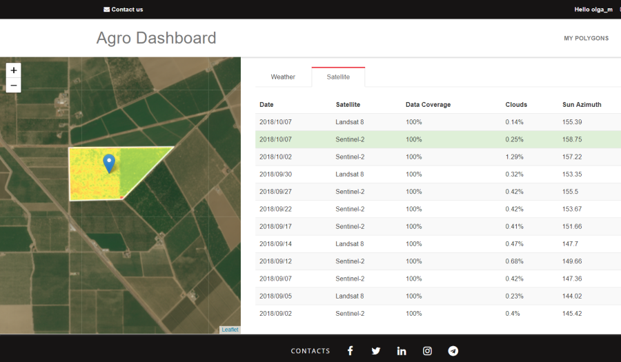
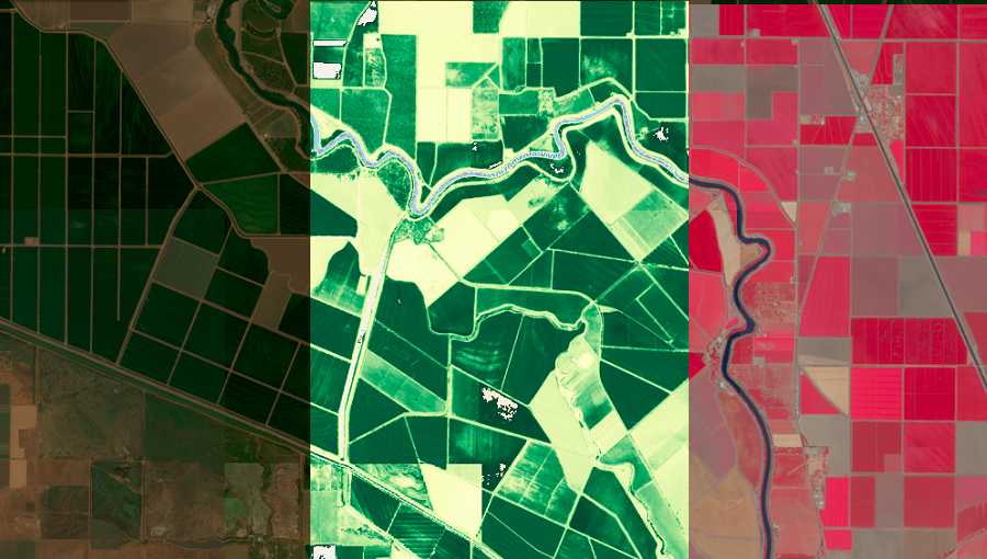
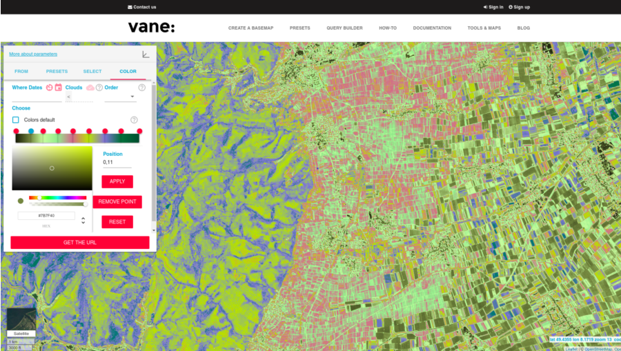
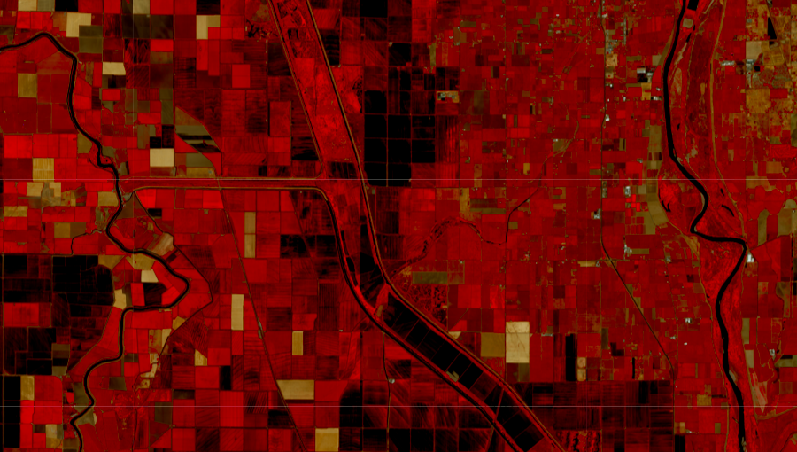
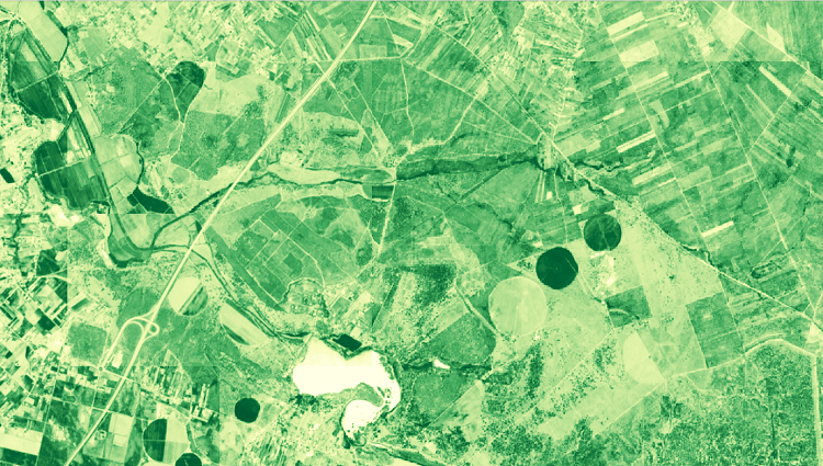
In this article, we would like to look in more detail at one of the essential elements of our Agro API: the Satellite Images API. The Satellite images API is the dataset from the Landsat 8 and Sentinel-2 satellites on the basis of which we calculate quantitative indices, such as NDVI, EVI and others, and from which we also obtain ready-made images of territories in True and False colour, NDVI and EVI.

We provide historical data as well as satellite images that are as up to date as possible (allowing for the data source and cloud cover) for the very nearest time period. These images are available to all account users, including those who are using the free package. For non-paying users, the range for satellite data requests is 6 days. For the paid service, it is one year. You can learn more about our pricing plans here.

Please note that there are limits to the total area for which you can request data, and to the number of requests that you can make per minute. However, should you exceed these figures, we will continue to provide you with the data you need so that your work is not affected and your customers will not run and hide!*

You can find all the details and the full set of the Agro API‘s capabilities here.

As always, we would be glad to hear your comments and suggestions regarding our product!

* At the end of your billing month, we will provide you with a separate bill for any additional area, beyond the tariff limits, for which you requested data.

We use cookies to personalize content and to analyze our traffic. Please decide if you are willing to accept cookies from our website.