

06 Aug 2018
Dive into the Agro API | Part 2 – Polygons
This article is a step-by-step description of how to work with polygons using our QueryBuilder and Agro API...
06 Aug 2018
This article is a step-by-step description of how to work with polygons using our QueryBuilder and Agro API...
13 Aug 2018
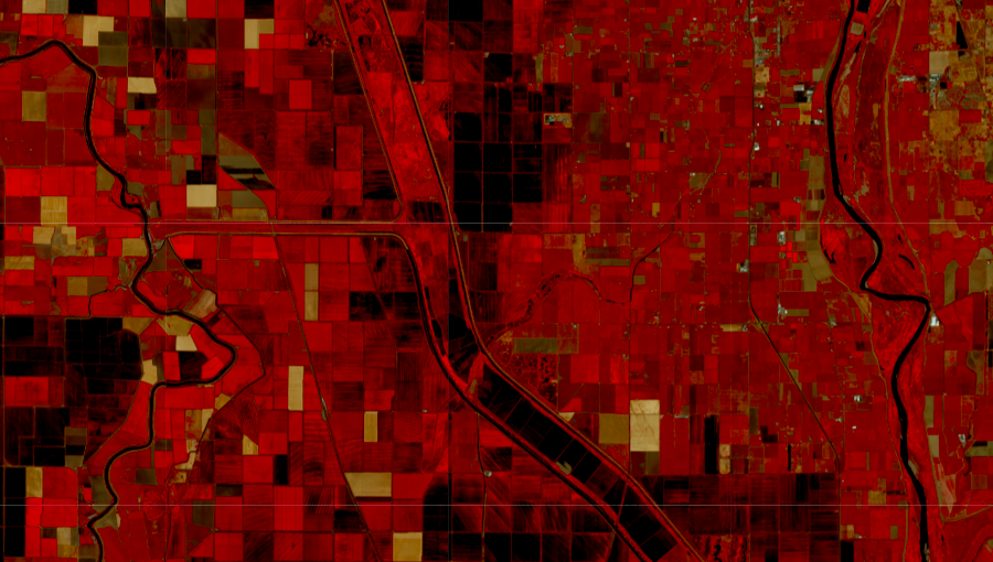
If you want to download Sentinel-2 satellite data, you’ve come to the right place! Our Satellite Images API was created exactly for this p...
19 Sep 2018
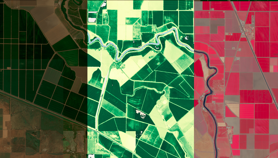
In the past, it was not easy to work with satellite imagery and use the images in applications. You had to have deep expertise in the satellite imagery area and have access to massive computing capacity. Fortunately, now this data is availabl...
17 Oct 2018
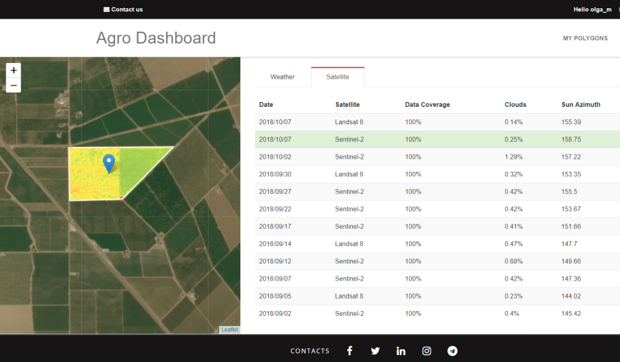
The Dashboard for Agricultural Monitoring is a service created for visual demonstration of satellite data (NDVI) and weather data (forecast, historical and accumulated parameters), which you can ge...
29 Oct 2018
The OpenWeather team announces Weather Maps 2.0, where you can now work not only with current weather layers but also with historical and forecast maps!
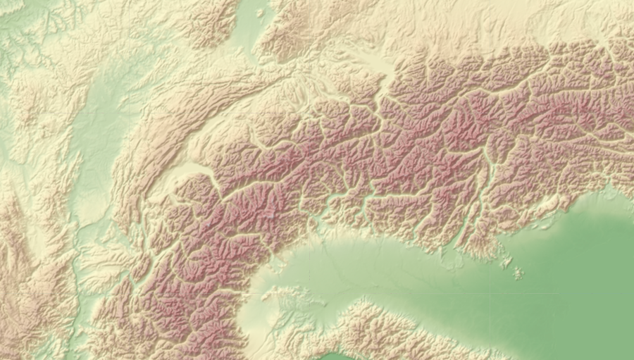
29 Nov 2018
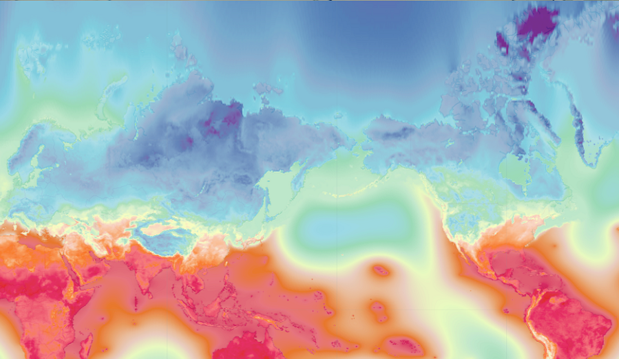
Relief Maps allows you to get relief maps from around the world. Set the position of the sun in your parameters and you will receive precise illumination of the earth’s surface and its relief for the conditions you have set.

01 Feb 2019
OpenWeather will help you easily and quickly move to our Weather API if you have been affected by the closure of the Weather Underground API.
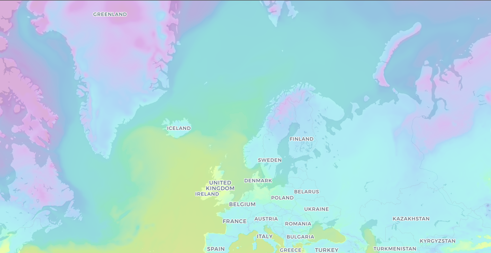
21 Feb 2019
Weather Map 2.0 and Relief Maps are products that allow d...

04 Apr 2019
The OpenWeather team is pleased to present you our new product, Hourly Forecast.

15 Jul 2019
Statistical Weather Data is an API that can provide its users with aggregated statistical weather data for cities.
Download OpenWeather app