
21 Jan 2020
Dive into Agro API | Part 4 – Satellite Imagery
The Satellite Imagery API is a part of our Agriculture API (Agro API) for the agricultural sector. OpenWeather<...
21 Jan 2020
The Satellite Imagery API is a part of our Agriculture API (Agro API) for the agricultural sector. OpenWeather<...

02 Jan 2020
So, the new 2020 is nearly upon us and it is time to sum up what we have done in 2019.

12 Dec 2019
Today, we would like to tell you more about one of the most requested weather services from OpenWeather - our Historical weather data. It is based on our new “Time Machine” weather technology.

05 Dec 2019
OpenWeather team is glad to present a new technology that greatly enhances our historical weather data. We have called it Time Machine.
30 Nov 2019
OpenWeather is delighted to offer fast and simple APIs for both weather data and satellite imagery.
Specifically for agro-users, we have selected a set of APIs that can be incredibly useful for work in the context of...
21 Oct 2019
Historical NDVI API is a part of an overall functionality of Agro API, a digital tool created for the needs of agricultural users.
06 Mar 2019
The OpenWeather team is pleased to present a new source of current data for the VANE platform service – two Modis satellites: Terra and Aqua.

01 Feb 2019
OpenWeather will help you easily and quickly move to our Weather API if you have been affected by the closure of the Weather Underground API.
29 Nov 2018
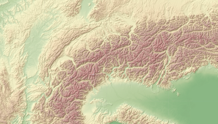
Relief Maps allows you to get relief maps from around the world. Set the position of the sun in your parameters and you will receive precise illumination of the earth’s surface and its relief for the conditions you have set.
17 Oct 2018
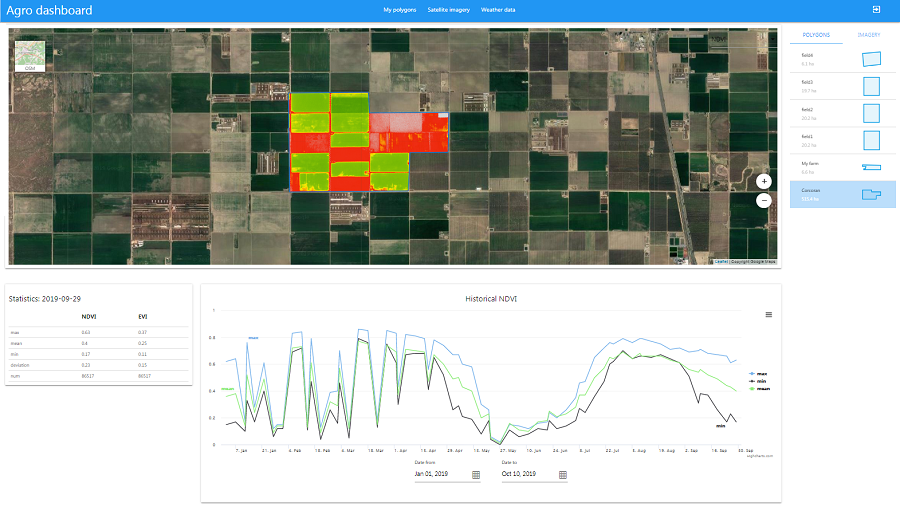
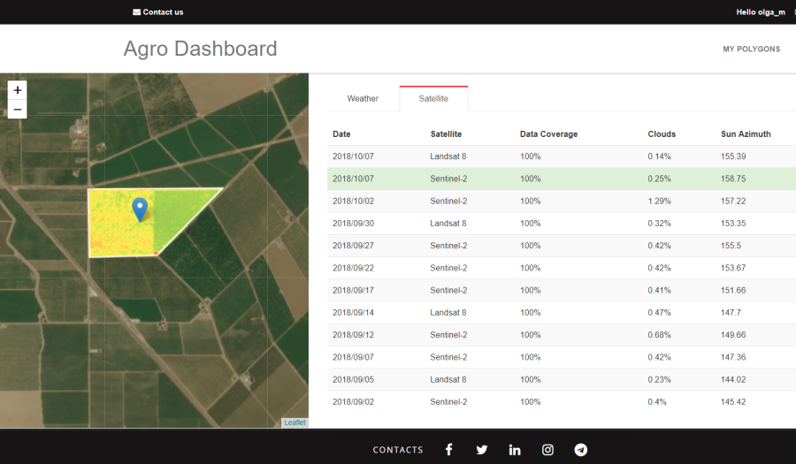
The Dashboard for Agricultural Monitoring is a service created for visual demonstration of satellite data (NDVI) and weather data (forecast, historical and accumulated parameters), which you can ge...
Download OpenWeather app