

28 May 2016
Map Editor 2.0 – the newest version of our tool for customising weather maps
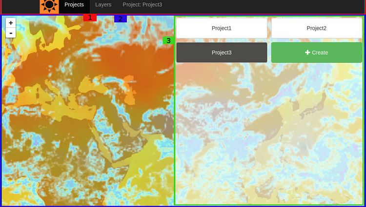
We at OpenWeatherMap are happy to announce our new useful, smart tool: Map Editor 2.0! It allows you to create personalised weather maps on the bas...
28 May 2016
We at OpenWeatherMap are happy to announce our new useful, smart tool: Map Editor 2.0! It allows you to create personalised weather maps on the bas...
01 Jul 2016
There are many online map services for those who prefer active leisure. For example, here is a map with bike routes: http://www.thunderforest.com/maps/opencyc...
11 Oct 2016
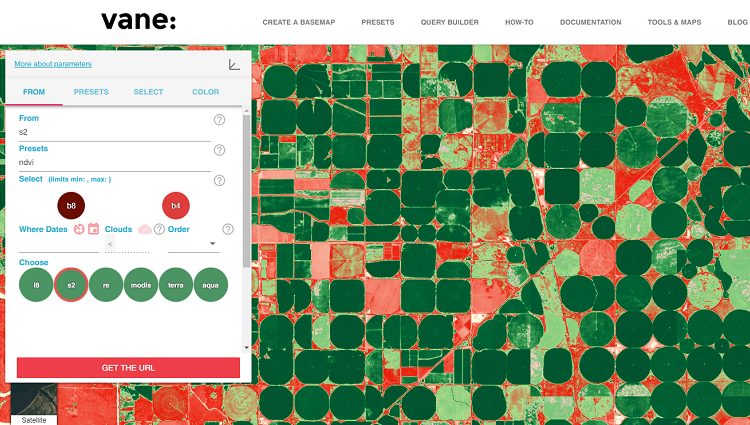
OpenWeatherMap presents the release of a new service – VANE Language (formerly Imagery API) – with examples here: http://owm.io/vaneLanguage.
We initially called this service the “Imagery API...
08 Dec 2016
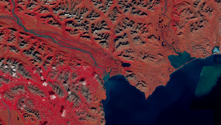
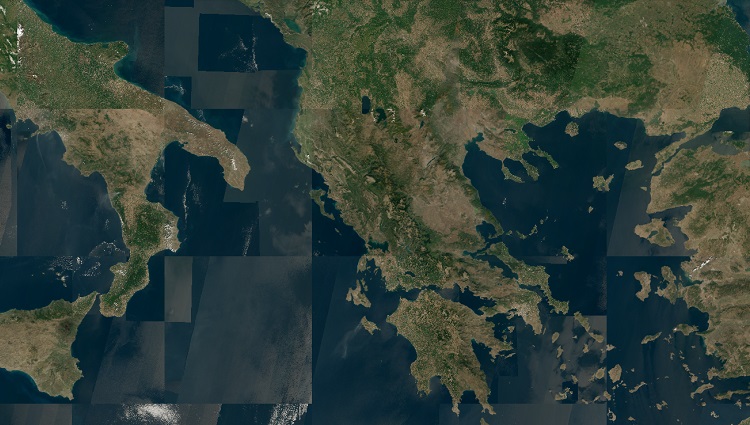
In the current version of the VANE Language, we use images from the Landsat 8 satellite, which captures the Earth’s entire surface every 16 days. The satellite makes hundreds of images, with a unique name for each on...
16 Jan 2017
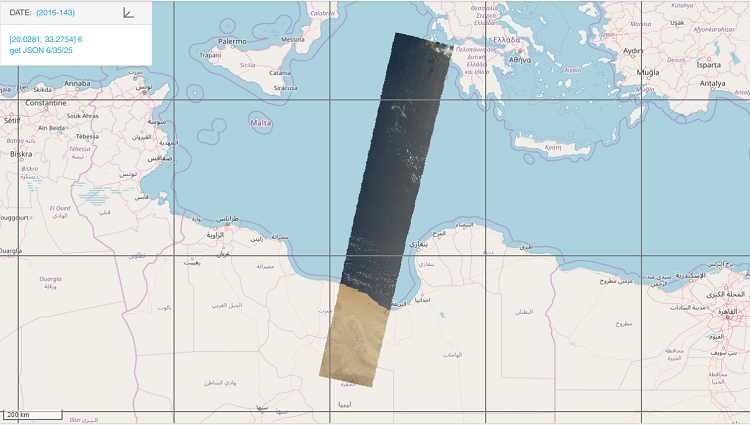
One of the benefits of the VANE platform is that there is no need to search by scenes and footprints. It is based on a simple assumption: each location in the world has metadata – click on any location and you can get informa...
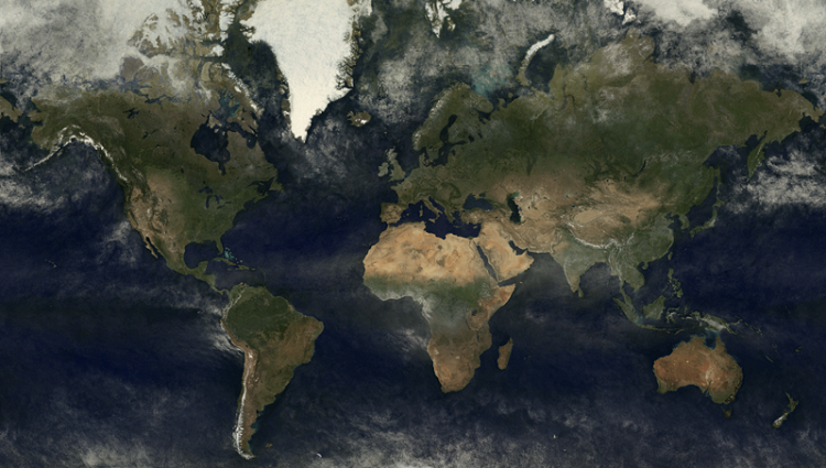
19 Dec 2017
The drawings show global coverage obtained between 1 June 2017 and 1 September 2017 using data from the MODIS spectroradiometer aboard KA Terra and Aqua.
The current cloudless coverage of the Earth by medium and low-resolut...

04 Jan 2018
So the, new year, 2018, has come, and it’s time to sum up the results of the past year for our company, OpenWeatherMap (UK, US and Latvia), developers of one of the best weather APIs in the world. A lot has happened and much has changed.
...
24 Jan 2018
The filter algorithm for selecting BEST coverage tiles has changed.
BEST is the method for overlaying images (parameter value order), and is the best way possible, depending on the parameters selected: date range, satellite, percent...
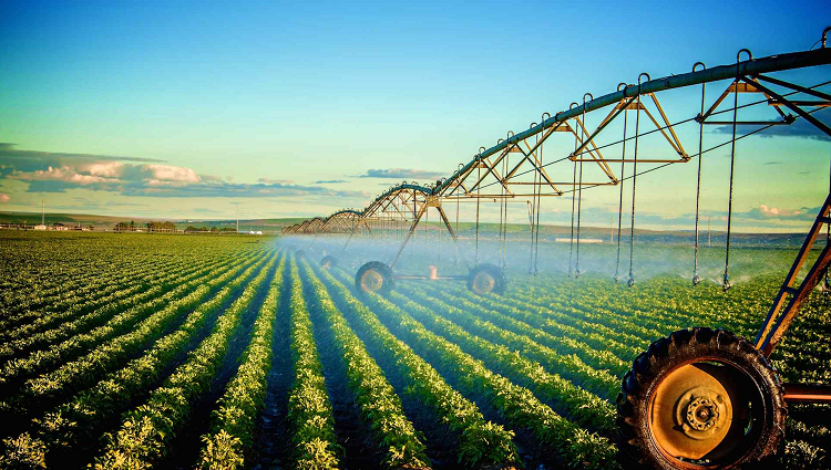
23 Apr 2018
The OpenWeather team are pleased to announce that we are launching a new product aimed primarily at specialists developing agricultural services and addressing the specific requirements ...
07 May 2018
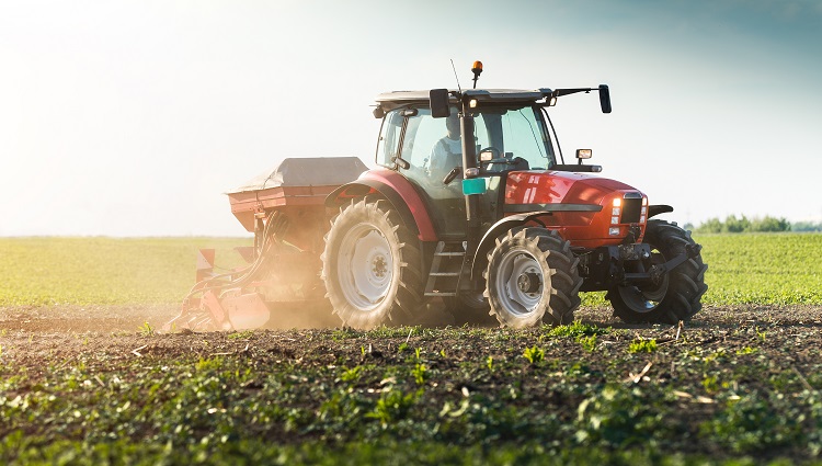
Objectives
As farms mainly consist of crop fields, which can be hundreds of acres in size, much time and a great deal of resources are demanded of farmers...
Download OpenWeather app