
19 Sep 2018
Query Builder Palette
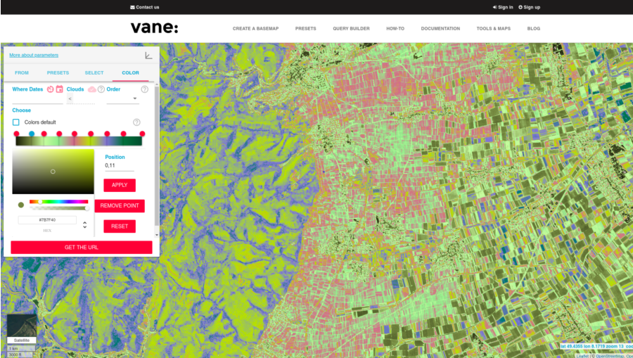
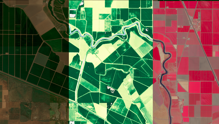
When you work with single-channel images, you need to focus in depth on a narrow range of values and clearly evaluate the researched data.
19 Sep 2018
When you work with single-channel images, you need to focus in depth on a narrow range of values and clearly evaluate the researched data.
19 Sep 2018
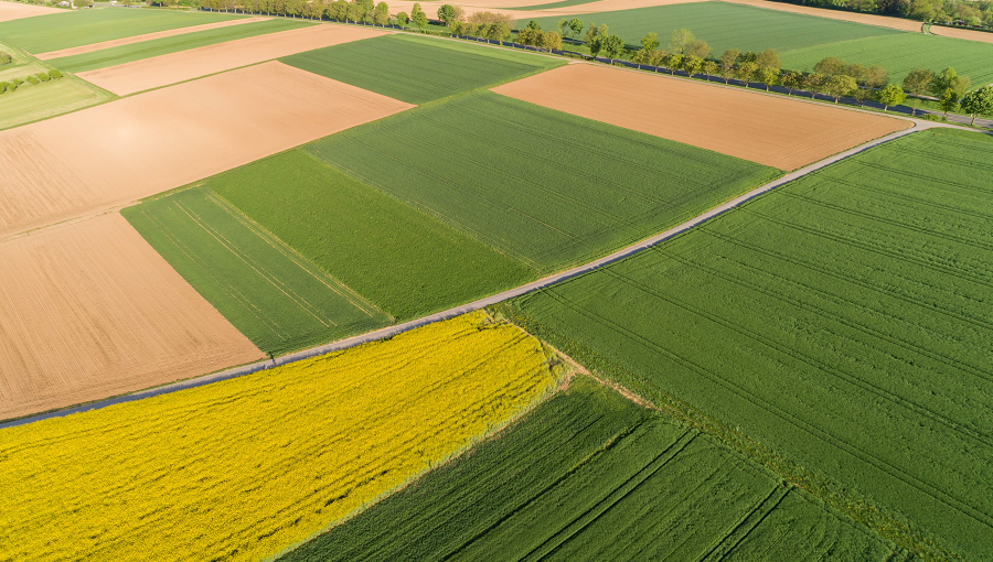
In the past, it was not easy to work with satellite imagery and use the images in applications. You had to have deep expertise in the satellite imagery area and have access to massive computing capacity. Fortunately, now this data is availabl...
17 Oct 2018
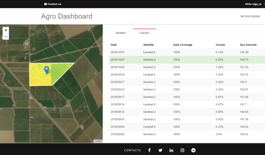
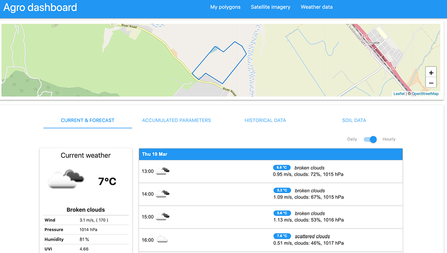
The Dashboard for Agricultural Monitoring is a service created for visual demonstration of satellite data (NDVI) and weather data (forecast, historical and accumulated parameters), which you can ge...
18 Mar 2019
The main purpose of this significantly advanced version of the Dashboard is to visually demonstrate to you all the data that we provide in our Agricultural API.
03 Apr 2019
We are pleased to tell you that we have launched the first version of our updated Dashboard!
01 May 2019
Now you can use our Weather Data function, in addition to those that are already implemented in the Dashboard.
22 Aug 2019
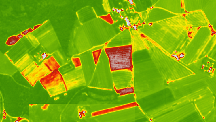
For developers of agricultural services or applications, we offer several predefined color palettes.
21 Oct 2019
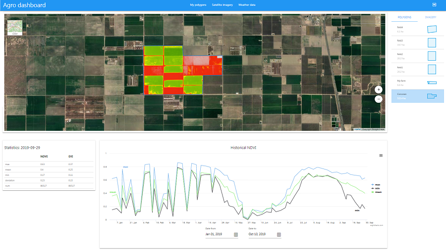
Historical NDVI API is a part of an overall functionality of Agro API, a digital tool created for the needs of agricultural users.
30 Nov 2019
OpenWeather is delighted to offer fast and simple APIs for both weather data and satellite imagery.
Specifically for agro-users, we have selected a set of APIs that can be incredibly useful for work in the context of...
21 Jan 2020
The Satellite Imagery API is a part of our Agriculture API (Agro API) for the agricultural sector. OpenWeather<...
Download OpenWeather app